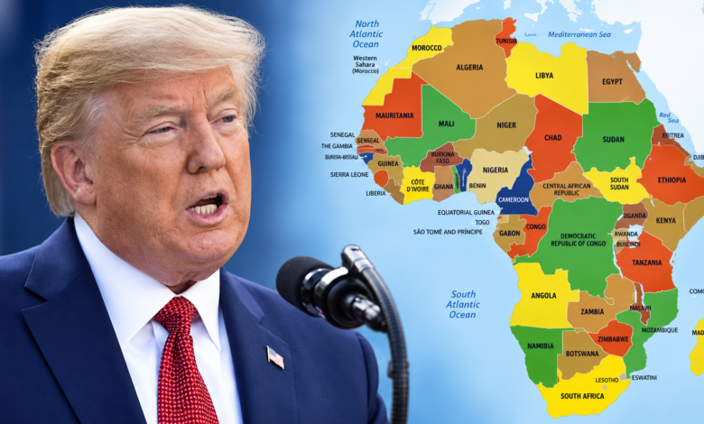
The United States voted against a United Nations resolution promoting a new world map that shows Africa much closer to its true size. The measure passed the UN General Assembly with 164 countries in favour and six abstentions, giving strong international backing to a shift away from the centuries-old Mercator projection for general world maps.
The resolution, led by Togo and backed by members of the African Union, promotes the Equal Earth projection, developed in 2018. It is designed to represent the relative size of continents more accurately than the Mercator map commonly seen in classrooms, offices and publications around the world.
However, the vote does not legally force governments, schools or technology companies to replace their maps, and it does not ban Mercator. The resolution is non-binding and encourages countries and institutions to use more accurate projections when displaying the world.
Why Africa looks smaller on traditional world maps
The Mercator projection was developed by Flemish cartographer Gerardus Mercator in 1569 primarily to help sailors navigate.

It made navigation easier because compass directions could be represented as straight lines, but that advantage came at a cost: the further a land mass is from the equator, the more its apparent size becomes distorted.
The result is one of the most familiar examples of map distortion.
On many Mercator maps, Greenland appears roughly comparable in size to Africa. In reality, Africa is about 14 times larger. Northern Europe and North America are also visually enlarged, while Africa, South America and countries closer to the equator appear relatively smaller.
Supporters of the UN resolution argue that such distortions matter because maps help shape how people understand geography, power and the importance of different regions.
Togo’s Foreign Minister, Robert Dussey, said ahead of the vote: “A fair world begins with a fair map.”
The debate forms part of a wider African push for greater representation in international institutions. New Daily Prime previously reported on Nigeria’s call for a stronger African voice at the UN, including President Bola Tinubu’s demand for [Nigeria to receive a permanent seat on the UN Security Council]. Read New Daily Prime’s report on Tinubu’s UN speech
Why the United States voted against
Washington stood alone in opposing the resolution.
US Ambassador to the UN Mike Waltz argued that what appeared to be a technical discussion about cartography was part of a wider ideological agenda. He accused supporters of focusing the UN on historical and political debates rather than what Washington regarded as more urgent international problems.
The US described the initiative as linked to a “radical ideological project” and argued that it distracted from questions of international peace, prosperity and relations between states.
Supporters rejected that interpretation, saying the proposal was about correcting an inaccurate visual representation of the world’s continents.
France and the UK were among the 164 countries that supported the measure. France has also indicated that it will move towards using an equal-area projection across government.
Six countries abstained: Estonia, Georgia, Lithuania, Moldova, Serbia and Ukraine. Ukraine said it had concerns about how some Equal Earth political maps represented Ukrainian territories occupied by Russia, rather than objecting to the principle of more accurate land sizes.
What changes after the UN vote?
The resolution encourages governments, educational institutions, international organisations, publishers and technology companies to consider using the Equal Earth projection.
Togo is expected to begin changing geography materials used in its schools, while campaigners want more accurate maps to appear in textbooks, newsrooms, businesses and digital platforms.
The change does not mean Mercator has become scientifically useless. It remains particularly useful for maritime and aerial navigation, because that was the purpose for which it was designed. The Togolese government has specifically said the UN resolution does not challenge its continued use for navigation.
The difference is that Equal Earth is better suited when the purpose of a map is to compare the actual area of countries and continents. The vote also comes as African governments seek greater influence over how the continent is represented internationally.
What readers should know
The UN has not ordered the world to throw away every existing map. Its 164-1 vote backs the wider use of the Equal Earth projection because it represents the relative size of continents, particularly Africa, more accurately. The United States was the only country to oppose the resolution, while six nations abstained. Mercator can still be used, especially for navigation, but the vote could accelerate changes in schools, government publications and digital mapping.
Related news
- Tinubu’s speech at UN General Assembly
- Tinubu takes South Africa xenophobia row to AU
- Israel recognises Somaliland as sovereign state, AU rejects decision